Best Of Mars Close-Up ( HQ Pics )


NASA'S Mars Reconnaissance Orbiter has circled the red planet since 2006. It has the High Resolution Imaging Science Experiment on board - a camera that takes high-resolution images of the Martian surface.
Here are just a few of the thousands of shots that the camera has taken.

Trails left by dust devils on sand dunes intersect and expose dark material below.
Mars polar regions are of great interest as they are known to contain records of past atmospheric, environmental, and climate conditions.
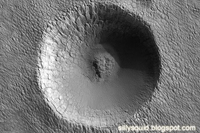
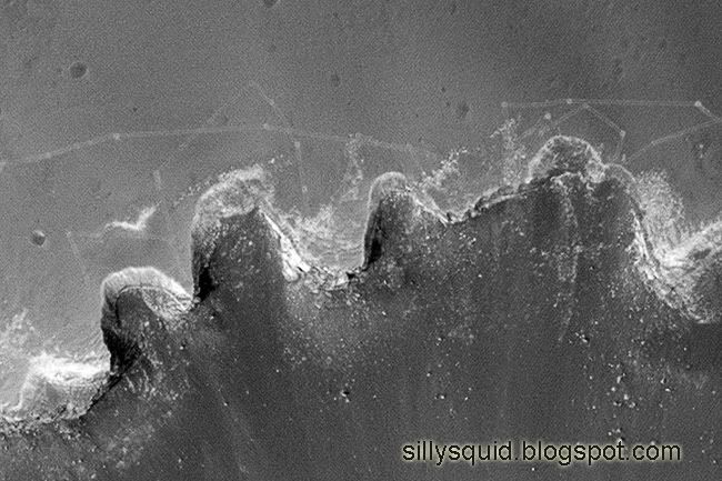
The impact crater - 330m in diameter - is used to estimate the age of the surface.
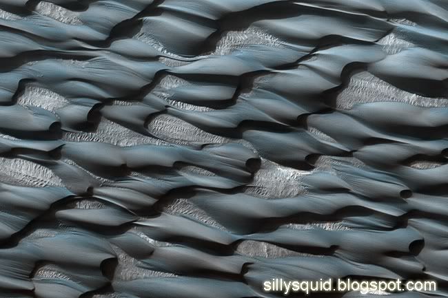
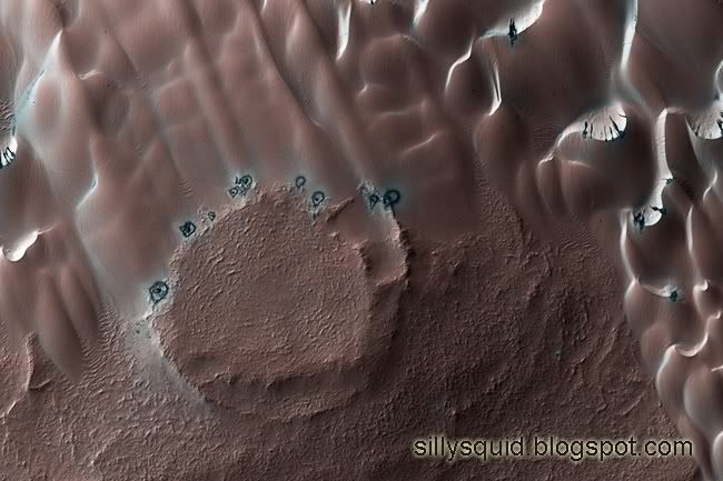
More than 10 per cent of the surface area in the North of Mars is covered by windblown sand dunes.
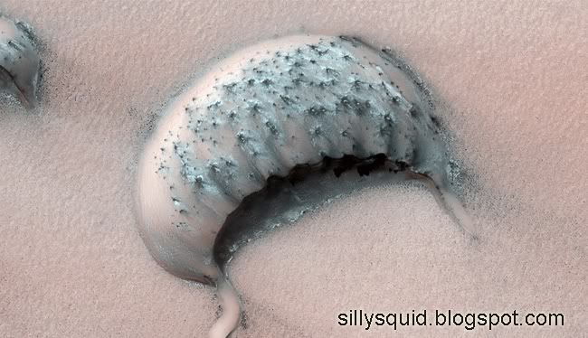
This large crescent-shaped hill is located in a region where some dunes have been shrinking.
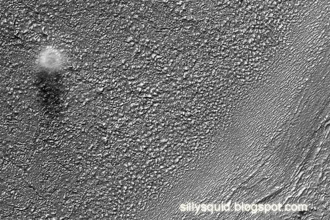
This image shows a dust devil blowing across the Martian surface.
Dust devils form when the temperature of the atmosphere near the ground is much warmer than that above.
The fading tracks of the Opportunity Rover near Victoria Crater.
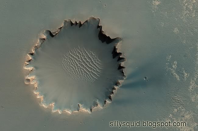
The Victoria Crater, near the equator of Mars, is approximately 800m in diameter.
The distinctive shape is caused by erosion and crater wall material moving downhill. A field of sand dunes sits on the crater floor.
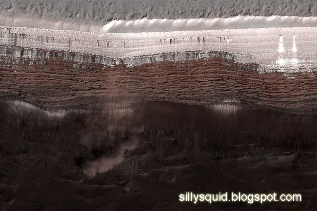
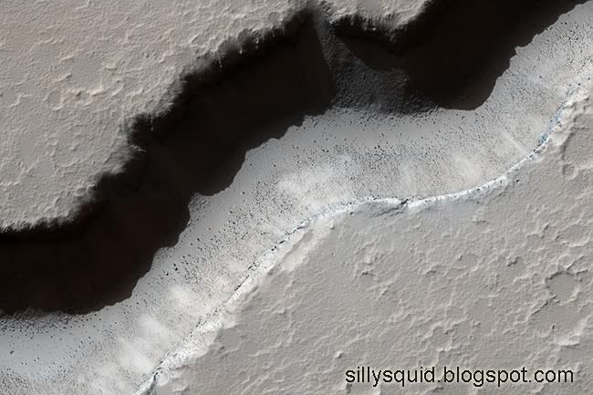
The orbiter snaps an avalanche in the planet's North Polar Scarps.
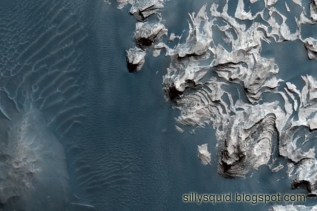
A portion of the Martian South Polar Cap shows layered formations created over many years.
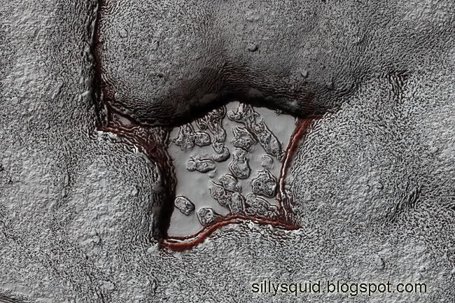
This 4km-wide feature, near the edge of Mars's south polar cap, has previously been photographed by other orbiters in the 1970s.
The bright areas are covered by carbon dioxide frost and the "swiss cheese" terrain is typical of the region.
Part of a long valley in Elysium Region Volcanic Rise.
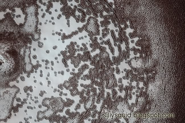
A seasonal polar cap of dry ice forms in the north polar region, covering a sea of dunes.
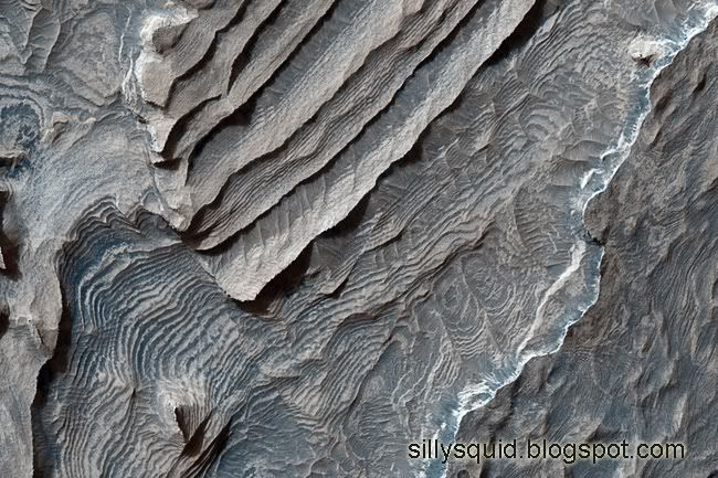
Each layer of deposits on the floor of Becquerel Crater are only a few metres thick.
The sediments may have come from windblown debris, volcanic ash in the sky, or a lake on the crater floor.
This area of hills in Aureum Chaos may have been caused by an outcrop of layered rock collapsing.